
This is going to be a long report because it was a long hike. To save space, pictures may be small on this page but they can be expanded on mobile devices by touching and spreading your fingers.
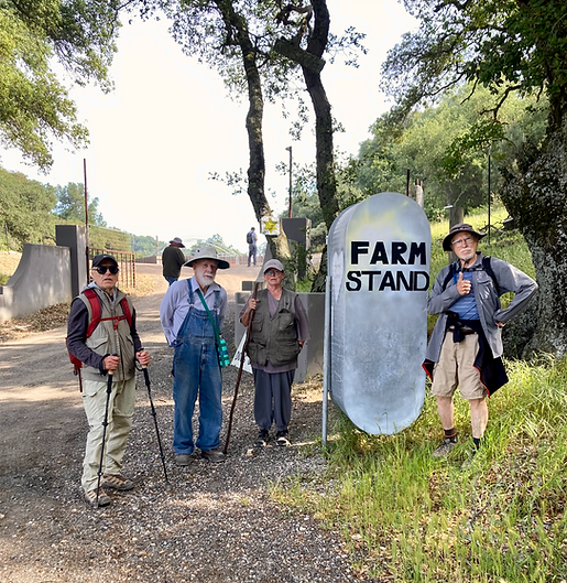
On Friday, May 16, 2025 we hiked the Mount Lowe trail East of Cuesta Grade to the cell towers. For the most part, the weather cooperated as we had fog at the start and although it warmed up as noon approached, it was not extreme. Fourteen hikers participated. We established our first "base camp" at the former Free Sample Cannabis Oasis about the 1.8 mile point. Honey and eggs were still being sold using a system that allowed you to pay by text and get a combination to open the storage chest. At the "Farm Stand" picture below you can see Russ headed in past the No Trespassing sign to explore further. He found a water faucet with water for hikers. As he continued, he photographed the now-abandoned pot greenhouses and operational bee hives. Continuing up the road takes you to a contemporary-styled occupied home.
After the hike, Russ was able to contact the owners using information from the signs. The man Bill Erickson and Russ met on their first trip (from Ireland) still lives there with his wife. They purchased the house from Woolpert who owns a senior care center and several local restaurants. The connection with Rob Rossi is still being investigated. The final comment from Chris' wife Karina was "We love to share, as we were hikers up here once as well." For the four of us that turned around at the first base camp, the round trip mileage was 3.6 miles with a elevation change of 538 feet. Time two hours. The track of this hike is shown in aqua in the picture directly below.


As the remaining 10 hikers continued up the trail, the group split in half again to form a second base camp at a point that was reported to be 4 miles into the trip. The remaining 5 hikers continued all the way to the summit at 2640 feet for a hike elevation change of 1894 feet with a Russ-provided recording GPS total hike mileage of 8.5 miles in 5 hours and 25 minutes. The track for the full hike is shown in brown on the green topographic map directly below. The true 8.5 mile round trip would mean the one-way mileage was 4.25 miles which places the reported 4 mile distance to the second base camp of 4 miles in question.
The "Conquerors of Mount Lowe" are to be congratulated. Several pictures below enshrine their accomplishment including the pineapple-sized pine cone discovered by Bill Sisler. Thanks go to Barbara, Bill Erickson, Steve Wilson and Greg Horne for their pictures and reports.


